
Image or Video
Image or Video
File Name
1. BroadEcosystem types.pngHeight
3508 pxWidth
2480 pxFile Type
PNG ImageFile Size
1.12 MBCreated Date
2024 Feb 02Updated Date
2024 Feb 02
Spatial Biodiversity Assessments
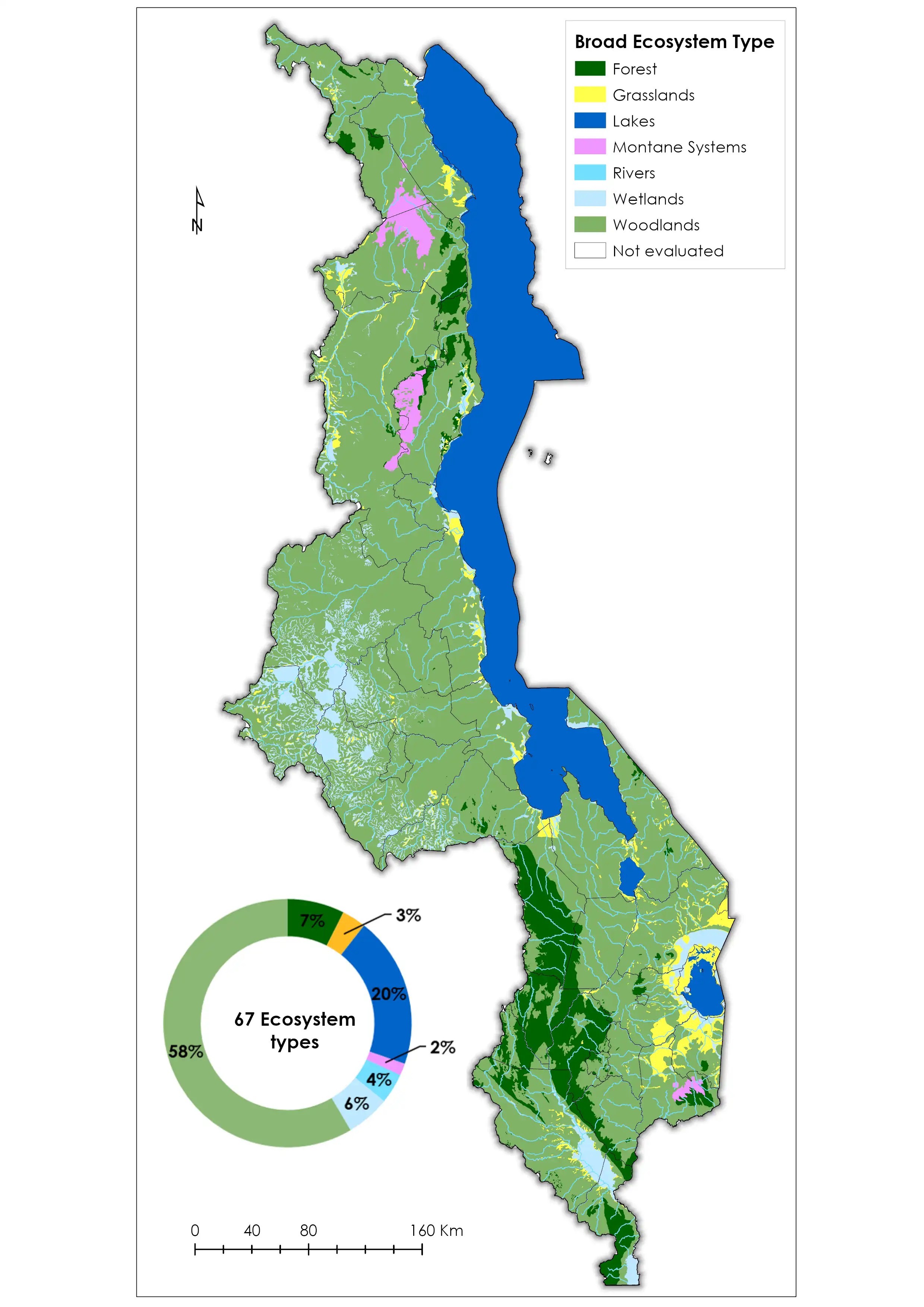
Malawi developed ecosystem maps through the Mapping Biodiversity Priorities Project implemented between 2017 - 2018. These maps laid the foundation for mainstreaming of spatial biodiversity information into government decision-making processes in Malawi. The key deliverable of Phase One was the generation of four integrated base data layers and the conducting of a spatial biodiversity assessment of ecosystem threat status and protection levels.
The maps developed were further refined in Phase Two of the Project, which then focused on integrating the maps into the Environmental and Social Impact Assessment Process, one of the key processes in achieving biodiversity conservation in a country.
The Maps below depict: 1) Malawi's broad ecosystem types; 2) Detailed Ecosystem Types; 3) Ecological Conditions; 4)Ecosystem Status; 5) Protected Areas; 6) Protected Level; and 7) Protected Level for intact ecosystems
File Name
1. BroadEcosystem types.pngHeight
3508 pxWidth
2480 pxFile Type
PNG ImageFile Size
1.12 MBCreated Date
2024 Feb 02Updated Date
2024 Feb 02